
Irdjen topographic map
Interactive map
Click on the map to display elevation.
About this map
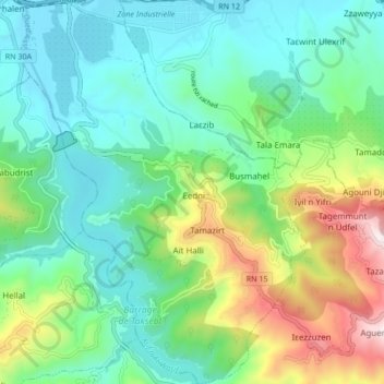
Name: Irdjen topographic map, elevation, terrain.
Location: Irdjen, Daïra Larbaa N'Aït Irathen, Tizi Ouzou, RADP (36.63425 4.10864 36.70201 4.17169)
Average elevation: 300 m
Minimum elevation: 74 m
Maximum elevation: 897 m