
Ushuaia topographic map
Interactive map
Click on the map to display elevation.
About this map
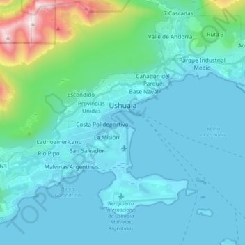
Name: Ushuaia topographic map, elevation, terrain.
Average elevation: 232 m
Minimum elevation: 0 m
Maximum elevation: 1,233 m
Other topographic maps
Click on a map to view its topography, its elevation and its terrain.
Calafate
Argentine > Province de Terre de Feu > Ushuaïa
Calafate, Ushuaia, Ushuaïa, Departamento Ushuaia, Province de Terre de Feu, Argentine
Average elevation: 98 m