
Thank you for supporting this site ❤️
Make a donation
Make a donation
Mirage City topographic map
Click on the map to display elevation.
Thank you for supporting this site ❤️
Make a donation
Make a donation
About this map
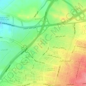
Name: Mirage City topographic map, elevation, terrain.
Location: Mirage City, Cairo, Egypt (30.05166 31.41537 30.09166 31.45537)
Average elevation: 190 m
Minimum elevation: 147 m
Maximum elevation: 240 m
Thank you for supporting this site ❤️
Make a donation
Make a donation
Other topographic maps
Click on a map to view its topography, its elevation and its terrain.