
Thank you for supporting this site ❤️
Make a donation
Make a donation
Radeberg topographic map
Click on the map to display elevation.
Thank you for supporting this site ❤️
Make a donation
Make a donation
About this map
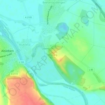
Name: Radeberg topographic map, elevation, terrain.
Location: Radeberg, Könnern, Salzlandkreis, Саксония-Анхальт, Германия (51.70100 11.69703 51.70110 11.69713)
Average elevation: 76 m
Minimum elevation: 59 m
Maximum elevation: 118 m
Thank you for supporting this site ❤️
Make a donation
Make a donation