
Thank you for supporting this site ❤️
Make a donation
Make a donation
Province of Cutervo topographic map
Click on the map to display elevation.
Thank you for supporting this site ❤️
Make a donation
Make a donation
About this map
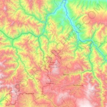
Name: Province of Cutervo topographic map, elevation, terrain.
Location: Province of Cutervo, Cajamarca, Peru (-6.55007 -79.27466 -5.78103 -78.50896)
Average elevation: 1,876 m
Minimum elevation: 424 m
Maximum elevation: 3,700 m
Thank you for supporting this site ❤️
Make a donation
Make a donation
Other topographic maps
Click on a map to view its topography, its elevation and its terrain.