
Thank you for supporting this site ❤️
Make a donation
Make a donation
Ottmarsheim topographic map
Click on the map to display elevation.
Thank you for supporting this site ❤️
Make a donation
Make a donation
Ottmarsheim
Ottmarsheim liegt 15 Kilometer östlich von Mülhausen auf einer Höhe von 220 m in der Rheinebene am Rheinseitenkanal und damit nur wenig von der Grenze zu Deutschland entfernt. In unmittelbarer Nähe verläuft die Autoroute A36 (La Comtoise) (Europastraße E54) und trifft nach der Rheinüberquerung auf die deutsche Bundesautobahn 5.
Thank you for supporting this site ❤️
Make a donation
Make a donation
About this map
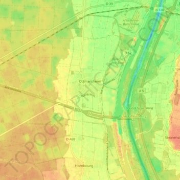
Name: Ottmarsheim topographic map, elevation, terrain.
Average elevation: 224 m
Minimum elevation: 200 m
Maximum elevation: 240 m
Thank you for supporting this site ❤️
Make a donation
Make a donation