
Thank you for supporting this site ❤️
Make a donation
Make a donation
Mauranipur topographic map
Click on the map to display elevation.
Thank you for supporting this site ❤️
Make a donation
Make a donation
About this map
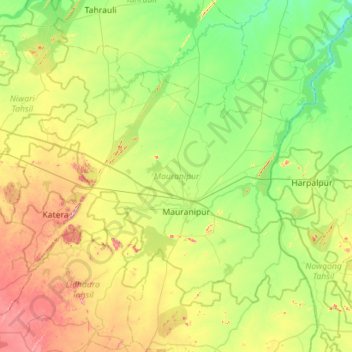
Name: Mauranipur topographic map, elevation, terrain.
Location: Mauranipur, Jhansi, Uttar Pradesh, India (25.10647 78.78712 25.48543 79.35127)
Average elevation: 218 m
Minimum elevation: 135 m
Maximum elevation: 395 m
Thank you for supporting this site ❤️
Make a donation
Make a donation