
Thank you for supporting this site ❤️
Make a donation
Make a donation
Birloka topographic map
Click on the map to display elevation.
Thank you for supporting this site ❤️
Make a donation
Make a donation
About this map
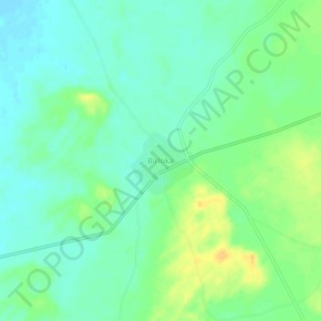
Name: Birloka topographic map, elevation, terrain.
Location: Birloka, Kheenvsar Tehsil, Nagaur, Rajasthan, India (26.95375 73.12607 26.99375 73.16607)
Average elevation: 300 m
Minimum elevation: 289 m
Maximum elevation: 318 m
Thank you for supporting this site ❤️
Make a donation
Make a donation