
Thank you for supporting this site ❤️
Make a donation
Make a donation
Lac Dawson topographic map
Click on the map to display elevation.
Thank you for supporting this site ❤️
Make a donation
Make a donation
About this map
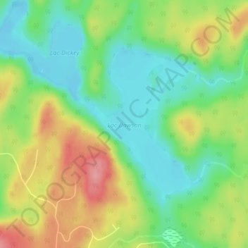
Name: Lac Dawson topographic map, elevation, terrain.
Location: Lac Dawson, Trois-Rives, Mékinac, Mauricie, Québec, Canada (47.06332 -72.84088 47.07968 -72.82268)
Average elevation: 337 m
Minimum elevation: 294 m
Maximum elevation: 401 m
Thank you for supporting this site ❤️
Make a donation
Make a donation
Other topographic maps
Click on a map to view its topography, its elevation and its terrain.