
Thank you for supporting this site ❤️
Make a donation
Make a donation
Gunung Prau topographic map
Click on the map to display elevation.
Thank you for supporting this site ❤️
Make a donation
Make a donation
About this map
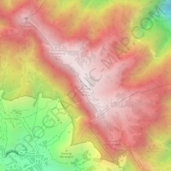
Name: Gunung Prau topographic map, elevation, terrain.
Location: Gunung Prau, Kendal, Central Java, Java, Indonesia (-7.19734 109.93218 -7.19724 109.93228)
Average elevation: 2,308 m
Minimum elevation: 1,776 m
Maximum elevation: 2,583 m
Thank you for supporting this site ❤️
Make a donation
Make a donation