
Thank you for supporting this site ❤️
Make a donation
Make a donation
Lac Kenny topographic map
Click on the map to display elevation.
Thank you for supporting this site ❤️
Make a donation
Make a donation
About this map
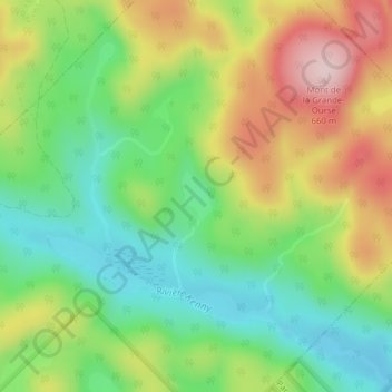
Name: Lac Kenny topographic map, elevation, terrain.
Location: Lac Kenny, Entrelacs, Matawinie, Lanaudière, Québec, Canada (46.15718 -73.98373 46.16064 -73.98086)
Average elevation: 484 m
Minimum elevation: 365 m
Maximum elevation: 654 m
Thank you for supporting this site ❤️
Make a donation
Make a donation
Other topographic maps
Click on a map to view its topography, its elevation and its terrain.