
Ngecha Tigoni ward topographic map
Interactive map
Click on the map to display elevation.
About this map
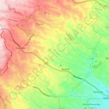
Name: Ngecha Tigoni ward topographic map, elevation, terrain.
Location: Ngecha Tigoni ward, Limuru, Kiambu, Central Kenya, Kenya (-1.19307 36.64004 -1.11925 36.73448)
Average elevation: 2,041 m
Minimum elevation: 1,799 m
Maximum elevation: 2,288 m