
Thank you for supporting this site ❤️
Make a donation
Make a donation
Nandwal topographic map
Click on the map to display elevation.
Thank you for supporting this site ❤️
Make a donation
Make a donation
About this map
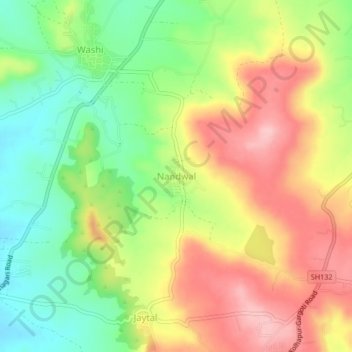
Name: Nandwal topographic map, elevation, terrain.
Location: Nandwal, Karvir, Kolhapur District, Maharashtra, 416221, India (16.60645 74.16305 16.64645 74.20305)
Average elevation: 635 m
Minimum elevation: 558 m
Maximum elevation: 717 m
Thank you for supporting this site ❤️
Make a donation
Make a donation
Other topographic maps
Click on a map to view its topography, its elevation and its terrain.