
Thank you for supporting this site ❤️
Make a donation
Make a donation
Piscotuna topographic map
Click on the map to display elevation.
Thank you for supporting this site ❤️
Make a donation
Make a donation
About this map
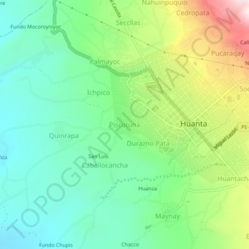
Name: Piscotuna topographic map, elevation, terrain.
Location: Piscotuna, Huanta, Ayacucho, Perú (-12.96006 -74.27937 -12.92006 -74.23937)
Average elevation: 2,554 m
Minimum elevation: 2,359 m
Maximum elevation: 2,962 m
Thank you for supporting this site ❤️
Make a donation
Make a donation
Other topographic maps
Click on a map to view its topography, its elevation and its terrain.