
Thank you for supporting this site ❤️
Make a donation
Make a donation
Minnertsga topographic map
Click on the map to display elevation.
Thank you for supporting this site ❤️
Make a donation
Make a donation
About this map
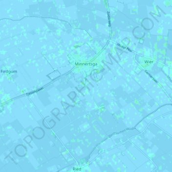
Name: Minnertsga topographic map, elevation, terrain.
Location: Minnertsga, Waadhoeke, Frisia, Netherlands (53.22547 5.55104 53.26516 5.62858)
Average elevation: 0 m
Minimum elevation: -3 m
Maximum elevation: 3 m
Thank you for supporting this site ❤️
Make a donation
Make a donation
Other topographic maps
Click on a map to view its topography, its elevation and its terrain.