
Thank you for supporting this site ❤️
Make a donation
Make a donation
Bukit Mutiara topographic map
Click on the map to display elevation.
Thank you for supporting this site ❤️
Make a donation
Make a donation
About this map
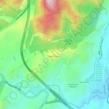
Name: Bukit Mutiara topographic map, elevation, terrain.
Location: Bukit Mutiara, Seremban, Negeri Sembilan, 70200, Malaysia (2.76967 101.92390 2.76977 101.92400)
Average elevation: 186 m
Minimum elevation: 73 m
Maximum elevation: 396 m
Thank you for supporting this site ❤️
Make a donation
Make a donation
Other topographic maps
Click on a map to view its topography, its elevation and its terrain.
Thank you for supporting this site ❤️
Make a donation
Make a donation
Thank you for supporting this site ❤️
Make a donation
Make a donation