
Reidling topographic map
Interactive map
Click on the map to display elevation.
About this map
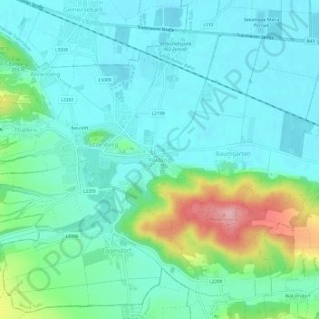
Name: Reidling topographic map, elevation, terrain.
Average elevation: 214 m
Minimum elevation: 179 m
Maximum elevation: 333 m
Other topographic maps
Click on a map to view its topography, its elevation and its terrain.
Neustift
Österreich > Niederösterreich > Bezirk Tulln > Gemeinde Sitzenberg-Reidling > Sitzenberg
Neustift, Sitzenberg, Gemeinde Sitzenberg-Reidling, Bezirk Tulln, Niederösterreich, 3454, Österreich
Average elevation: 218 m