
De Veenhoop topographic map
Interactive map
Click on the map to display elevation.
About this map
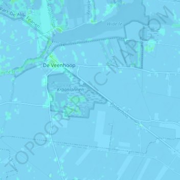
Name: De Veenhoop topographic map, elevation, terrain.
Location: De Veenhoop, Smallingerland, Friesland, Niederlande (53.07731 5.92666 53.10533 5.99253)
Average elevation: -1 m
Minimum elevation: -4 m
Maximum elevation: 5 m
Other topographic maps
Click on a map to view its topography, its elevation and its terrain.
Goëngahuizen
Niederlande > Friesland > Smallingerland
Goëngahuizen, Smallingerland, Friesland, Niederlande
Average elevation: 0 m
Drachtstercompagnie
Niederlande > Friesland > Smallingerland
Drachtstercompagnie, Smallingerland, Friesland, Niederlande
Average elevation: 4 m
Smalle Ee
Niederlande > Friesland > Smallingerland
Smalle Ee, Smallingerland, Friesland, Niederlande
Average elevation: 0 m
Boornbergum
Niederlande > Friesland > Smallingerland
Boornbergum, Smallingerland, Friesland, Niederlande
Average elevation: 0 m
Houtigehage
Niederlande > Friesland > Smallingerland
Houtigehage, Smallingerland, Friesland, Niederlande
Average elevation: 3 m
Smallingerland
Niederlande > Friesland > Smallingerland
Smallingerland, Friesland, Niederlande
Average elevation: 1 m
Nijega
Niederlande > Friesland > Smallingerland
Nijega, Smallingerland, Friesland, Niederlande
Average elevation: 1 m