
Thank you for supporting this site ❤️
Make a donation
Make a donation
Ha Tsiu topographic map
Click on the map to display elevation.
Thank you for supporting this site ❤️
Make a donation
Make a donation
About this map
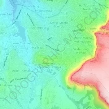
Name: Ha Tsiu topographic map, elevation, terrain.
Location: Ha Tsiu, Maseru District, 100, Lesotho (-29.34330 27.50880 -29.30330 27.54880)
Average elevation: 1,598 m
Minimum elevation: 1,499 m
Maximum elevation: 1,845 m
Thank you for supporting this site ❤️
Make a donation
Make a donation
Other topographic maps
Click on a map to view its topography, its elevation and its terrain.