
Thank you for supporting this site ❤️
Make a donation
Make a donation
Iseringhausen topographic map
Click on the map to display elevation.
Thank you for supporting this site ❤️
Make a donation
Make a donation
Iseringhausen
Iseringhausen liegt auf einer Höhe von um die 377 m im südwestlichen Sauerland etwa drei Kilometer südlich des Drolshagener Zentrums und sieben Kilometer südwestlich von Olpe. Iseringhausen liegt im Brachtpetal umgeben von den Hügeln des südwestlichen Sauerlandes unweit des Biggesee.
Thank you for supporting this site ❤️
Make a donation
Make a donation
About this map
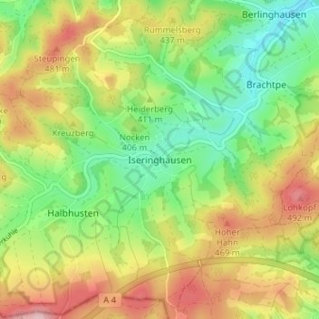
Name: Iseringhausen topographic map, elevation, terrain.
Average elevation: 408 m
Minimum elevation: 320 m
Maximum elevation: 522 m
Thank you for supporting this site ❤️
Make a donation
Make a donation