
Soledad de Graciano Sánchez topographic map
Interactive map
Click on the map to display elevation.
About this map
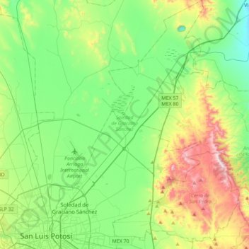
Name: Soledad de Graciano Sánchez topographic map, elevation, terrain.
Location: Soledad de Graciano Sánchez, San Luis Potosí, México (22.13490 -100.96801 22.45510 -100.75530)
Average elevation: 1,900 m
Minimum elevation: 1,683 m
Maximum elevation: 2,424 m
Other topographic maps
Click on a map to view its topography, its elevation and its terrain.
Ciudad Valles
México > San Luis Potosí > Ciudad Valles
Ciudad Valles, San Luis Potosí, 79000, México
Average elevation: 181 m