
Dutton topographic map
Interactive map
Click on the map to display elevation.
About this map
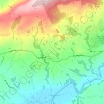
Name: Dutton topographic map, elevation, terrain.
Location: Dutton, Ribble Valley, Lancashire, Inglaterra, Reino Unido (53.81255 -2.53521 53.86296 -2.48564)
Average elevation: 134 m
Minimum elevation: 24 m
Maximum elevation: 335 m