
Thank you for supporting this site ❤️
Make a donation
Make a donation
Staro Petrovo Selo topographic map
Click on the map to display elevation.
Thank you for supporting this site ❤️
Make a donation
Make a donation
Staro Petrovo Selo
It is located between the southern slopes of the Požeška gora mountain and the Sava river plain in the region of Slavonia, 12 km (7.5 mi) southeast of Nova Gradiška, at an elevation of 91 m.
Thank you for supporting this site ❤️
Make a donation
Make a donation
About this map
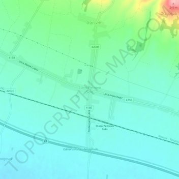
Name: Staro Petrovo Selo topographic map, elevation, terrain.
Average elevation: 128 m
Minimum elevation: 99 m
Maximum elevation: 243 m
Thank you for supporting this site ❤️
Make a donation
Make a donation
Other topographic maps
Click on a map to view its topography, its elevation and its terrain.