
Thank you for supporting this site ❤️
Make a donation
Make a donation
New Hill topographic map
Click on the map to display elevation.
Thank you for supporting this site ❤️
Make a donation
Make a donation
About this map
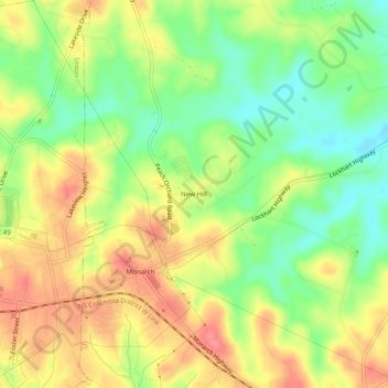
Name: New Hill topographic map, elevation, terrain.
Location: New Hill, Union County, South Carolina, 29379, United States (34.70652 -81.60982 34.74652 -81.56982)
Average elevation: 164 m
Minimum elevation: 125 m
Maximum elevation: 201 m
Thank you for supporting this site ❤️
Make a donation
Make a donation
Other topographic maps
Click on a map to view its topography, its elevation and its terrain.