
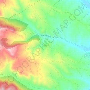
Πτελέα topographic map
Interactive map
Click on the map to display elevation.
About this map
Name: Πτελέα topographic map, elevation, terrain.
Average elevation: 873 m
Minimum elevation: 740 m
Maximum elevation: 1,066 m
Other topographic maps
Click on a map to view its topography, its elevation and its terrain.
Καστοριά
Greece > Epirus and Western Macedonia > Kastoria Regional Unit
Καστοριά, Municipality of Kastoria, Kastoria Regional Unit, Western Macedonia, Epirus and Western Macedonia, 521 00, Greece
Average elevation: 949 m
Μεσοποταμία
Greece > Epirus and Western Macedonia > Kastoria Regional Unit > Μεσοποταμία
Μεσοποταμία, Municipality of Kastoria, Kastoria Regional Unit, Western Macedonia, Epirus and Western Macedonia, 52050, Greece
Average elevation: 724 m
Lithia
Greece > Epirus and Western Macedonia > Kastoria Regional Unit > Lithia
Lithia, Municipality of Kastoria, Kastoria Regional Unit, Western Macedonia, Epirus and Western Macedonia, 52052, Greece
Average elevation: 873 m