
Muntanitz topographic map
Interactive map
Click on the map to display elevation.
About this map
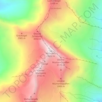
Name: Muntanitz topographic map, elevation, terrain.
Location: Muntanitz, Matrei in Osttirol, Lienz, Tirol, Österreich (47.07356 12.58893 47.07366 12.58903)
Average elevation: 2,744 m
Minimum elevation: 2,255 m
Maximum elevation: 3,198 m
Other topographic maps
Click on a map to view its topography, its elevation and its terrain.
Nationalpark Hohe Tauern
Österreich > Tirol > Matrei in Osttirol
Nationalpark Hohe Tauern, Wildenkogelweg, Matrei in Osttirol, Lienz, Tirol, 9971, Österreich
Average elevation: 2,125 m