
Thank you for supporting this site ❤️
Make a donation
Make a donation
Gunung Antasari topographic map
Click on the map to display elevation.
Thank you for supporting this site ❤️
Make a donation
Make a donation
About this map
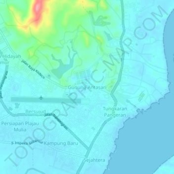
Name: Gunung Antasari topographic map, elevation, terrain.
Location: Gunung Antasari, Tanah Bumbu, Kalimantan du Sud, Indonésie (-3.42956 115.98479 -3.38956 116.02479)
Average elevation: 13 m
Minimum elevation: -1 m
Maximum elevation: 104 m
Thank you for supporting this site ❤️
Make a donation
Make a donation