
Saïo topographic map
Interactive map
Click on the map to display elevation.
About this map
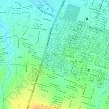
Name: Saïo topographic map, elevation, terrain.
Location: Saïo, Ngiri-Ngiri, Kinshasa, Democratic Republic of the Congo (-4.36182 15.28785 -4.35307 15.29525)
Average elevation: 301 m
Minimum elevation: 288 m
Maximum elevation: 323 m
Other topographic maps
Click on a map to view its topography, its elevation and its terrain.
Lukaya
Democratic Republic of the Congo > Kinshasa > Kasa-Vubu 1
Lukaya, Kasa-Vubu 1, Mont Ngafula, Kinshasa, 31, Democratic Republic of the Congo
Average elevation: 313 m
Katanga
Democratic Republic of the Congo > Kinshasa > Kinshasa
Katanga, Kasa-Vubu, Kinshasa, Democratic Republic of the Congo
Average elevation: 293 m