
Thank you for supporting this site ❤️
Make a donation
Make a donation
Drolshagen topographic map
Click on the map to display elevation.
Thank you for supporting this site ❤️
Make a donation
Make a donation
About this map
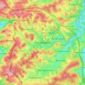
Name: Drolshagen topographic map, elevation, terrain.
Location: Drolshagen, Kreis Olpe, Nordrhein-Westfalen, 57489, Deutschland (50.98399 7.73407 51.06399 7.81407)
Average elevation: 405 m
Minimum elevation: 305 m
Maximum elevation: 519 m
Thank you for supporting this site ❤️
Make a donation
Make a donation