
Thank you for supporting this site ❤️
Make a donation
Make a donation
Cosenberg topographic map
Click on the map to display elevation.
Thank you for supporting this site ❤️
Make a donation
Make a donation
About this map
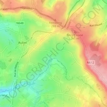
Name: Cosenberg topographic map, elevation, terrain.
Location: Cosenberg, Aubel, Verviers, Liège, Wallonie, 4880, Belgique (50.67997 5.85684 50.71997 5.89684)
Average elevation: 244 m
Minimum elevation: 180 m
Maximum elevation: 318 m
Thank you for supporting this site ❤️
Make a donation
Make a donation