
Węgrów topographic map
Interactive map
Click on the map to display elevation.
About this map
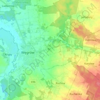
Name: Węgrów topographic map, elevation, terrain.
Location: Węgrów, Węgrów County, Masovian Voivodeship, 07-100, Poland (52.36112 21.97019 52.44051 22.08909)
Average elevation: 138 m
Minimum elevation: 116 m
Maximum elevation: 178 m