
Thank you for supporting this site ❤️
Make a donation
Make a donation
Pittsview topographic map
Click on the map to display elevation.
Thank you for supporting this site ❤️
Make a donation
Make a donation
About this map
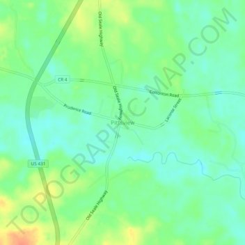
Name: Pittsview topographic map, elevation, terrain.
Location: Pittsview, Russell County, Alabama, 36871, United States (32.16821 -85.18327 32.20821 -85.14327)
Average elevation: 79 m
Minimum elevation: 64 m
Maximum elevation: 105 m
Thank you for supporting this site ❤️
Make a donation
Make a donation
Other topographic maps
Click on a map to view its topography, its elevation and its terrain.