
Rivière aux Orignaux topographic map
Interactive map
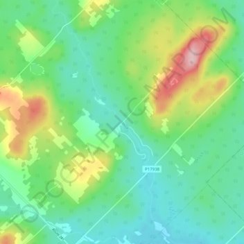
Click on the map to display elevation.
About this map
Name: Rivière aux Orignaux topographic map, elevation, terrain.
Average elevation: 439 m
Minimum elevation: 381 m
Maximum elevation: 575 m
Other topographic maps
Click on a map to view its topography, its elevation and its terrain.
Rivière Noire
Canada > Québec > Saint-Magloire
Rivière Noire, Saint-Magloire, Les Etchemins, Chaudière-Appalaches, Québec, Canada
Average elevation: 392 m
Lac Forgues
Canada > Québec > Saint-Magloire
Lac Forgues, Rang Saint-Cyrille, Saint-Magloire, Les Etchemins, Chaudière-Appalaches, Québec, G0R 1T0, Canada
Average elevation: 519 m