
Thank you for supporting this site ❤️
Make a donation
Make a donation
Hanover topographic map
Click on the map to display elevation.
Thank you for supporting this site ❤️
Make a donation
Make a donation
About this map
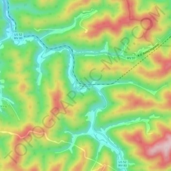
Name: Hanover topographic map, elevation, terrain.
Location: Hanover, Wyoming County, West Virginia, 24839, United States (37.55289 -81.81956 37.59289 -81.77956)
Average elevation: 430 m
Minimum elevation: 290 m
Maximum elevation: 609 m
Thank you for supporting this site ❤️
Make a donation
Make a donation
Other topographic maps
Click on a map to view its topography, its elevation and its terrain.