
Thank you for supporting this site ❤️
Make a donation
Make a donation
Fenn Haven topographic map
Click on the map to display elevation.
Thank you for supporting this site ❤️
Make a donation
Make a donation
About this map
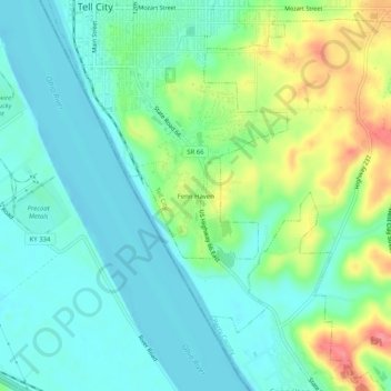
Name: Fenn Haven topographic map, elevation, terrain.
Location: Fenn Haven, Tell City, Perry County, Indiana, United States (37.91144 -86.77665 37.95144 -86.73665)
Average elevation: 137 m
Minimum elevation: 111 m
Maximum elevation: 199 m
Thank you for supporting this site ❤️
Make a donation
Make a donation