
Thank you for supporting this site ❤️
Make a donation
Make a donation
Condorillo Alto topographic map
Click on the map to display elevation.
Thank you for supporting this site ❤️
Make a donation
Make a donation
About this map
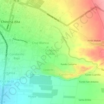
Name: Condorillo Alto topographic map, elevation, terrain.
Location: Condorillo Alto, Chincha Alta, Chincha, Ica, 11700, Perú (-13.44922 -76.13610 -13.40922 -76.09610)
Average elevation: 107 m
Minimum elevation: 59 m
Maximum elevation: 173 m
Thank you for supporting this site ❤️
Make a donation
Make a donation
Other topographic maps
Click on a map to view its topography, its elevation and its terrain.