
Thank you for supporting this site ❤️
Make a donation
Make a donation
Kampung Sahom topographic map
Click on the map to display elevation.
Thank you for supporting this site ❤️
Make a donation
Make a donation
About this map
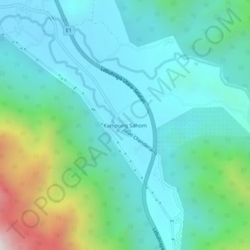
Name: Kampung Sahom topographic map, elevation, terrain.
Location: Kampung Sahom, Kampar, Perak, Malaysia (4.34869 101.20700 4.38869 101.24700)
Average elevation: 271 m
Minimum elevation: 38 m
Maximum elevation: 1,143 m
Thank you for supporting this site ❤️
Make a donation
Make a donation
Other topographic maps
Click on a map to view its topography, its elevation and its terrain.