
Thank you for supporting this site ❤️
Make a donation
Make a donation
Täuffelen topographic map
Click on the map to display elevation.
Thank you for supporting this site ❤️
Make a donation
Make a donation
About this map
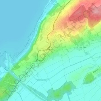
Name: Täuffelen topographic map, elevation, terrain.
Average elevation: 458 m
Minimum elevation: 425 m
Maximum elevation: 554 m
Thank you for supporting this site ❤️
Make a donation
Make a donation
Other topographic maps
Click on a map to view its topography, its elevation and its terrain.
Scheunenberg
Suisse > Berne > Arrondissement administratif du Seeland > Wengi
Average elevation: 520 m
Chouchignies
Suisse > Berne > Arrondissement administratif du Seeland > Kallnach > Chouchignies
Average elevation: 468 m