
Thank you for supporting this site ❤️
Make a donation
Make a donation
Skofttorp topographic map
Click on the map to display elevation.
Thank you for supporting this site ❤️
Make a donation
Make a donation
About this map
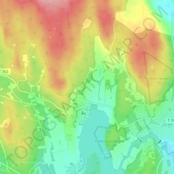
Name: Skofttorp topographic map, elevation, terrain.
Location: Skofttorp, Ås, Nora kommun, Örebro län, 713 33, Sverige (59.51443 14.97070 59.55443 15.01070)
Average elevation: 143 m
Minimum elevation: 87 m
Maximum elevation: 217 m
Thank you for supporting this site ❤️
Make a donation
Make a donation