
Thank you for supporting this site ❤️
Make a donation
Make a donation
Bayung Gede topographic map
Click on the map to display elevation.
Thank you for supporting this site ❤️
Make a donation
Make a donation
About this map
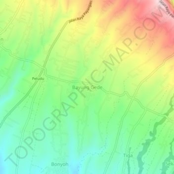
Name: Bayung Gede topographic map, elevation, terrain.
Location: Bayung Gede, Bangli, Bali, Lesser Sunda Islands, Indonesia (-8.31183 115.30943 -8.27183 115.34943)
Average elevation: 1,146 m
Minimum elevation: 1,004 m
Maximum elevation: 1,364 m
Thank you for supporting this site ❤️
Make a donation
Make a donation