
Thank you for supporting this site ❤️
Make a donation
Make a donation
County Monaghan topographic map
Click on the map to display elevation.
Thank you for supporting this site ❤️
Make a donation
Make a donation
About this map
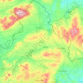
Name: County Monaghan topographic map, elevation, terrain.
Location: County Monaghan, Ireland (53.90064 -7.33956 54.42137 -6.54983)
Average elevation: 115 m
Minimum elevation: 11 m
Maximum elevation: 379 m
Thank you for supporting this site ❤️
Make a donation
Make a donation
Other topographic maps
Click on a map to view its topography, its elevation and its terrain.