Serra do Rio do Rastro topographic map
Click on the map to display elevation.
About this map
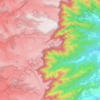
Name: Serra do Rio do Rastro topographic map, elevation, terrain.
Average elevation: 996 m
Minimum elevation: 301 m
Maximum elevation: 1,569 m

Click on the map to display elevation.
Name: Serra do Rio do Rastro topographic map, elevation, terrain.
Average elevation: 996 m
Minimum elevation: 301 m
Maximum elevation: 1,569 m