
Thank you for supporting this site ❤️
Make a donation
Make a donation
Sari Tani topographic map
Click on the map to display elevation.
Thank you for supporting this site ❤️
Make a donation
Make a donation
About this map
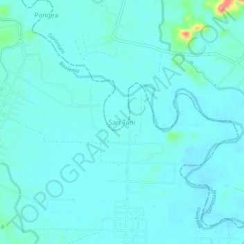
Name: Sari Tani topographic map, elevation, terrain.
Location: Sari Tani, Gorontalo, Sulawesi, Indonesia (0.71566 122.46367 0.75566 122.50367)
Average elevation: 40 m
Minimum elevation: 28 m
Maximum elevation: 127 m
Thank you for supporting this site ❤️
Make a donation
Make a donation
Other topographic maps
Click on a map to view its topography, its elevation and its terrain.