
Thank you for supporting this site ❤️
Make a donation
Make a donation
Lal Kuan topographic map
Click on the map to display elevation.
Thank you for supporting this site ❤️
Make a donation
Make a donation
About this map
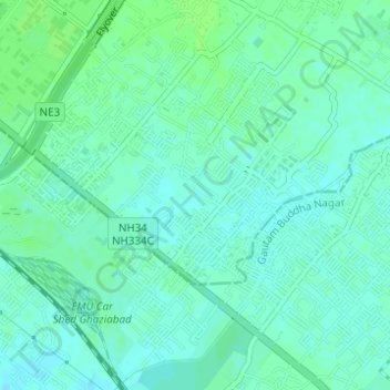
Name: Lal Kuan topographic map, elevation, terrain.
Location: Lal Kuan, Ghaziabad, Uttar Pradesh, 201016, India (28.62338 77.46372 28.64338 77.48372)
Average elevation: 211 m
Minimum elevation: 207 m
Maximum elevation: 215 m
Thank you for supporting this site ❤️
Make a donation
Make a donation
Other topographic maps
Click on a map to view its topography, its elevation and its terrain.