
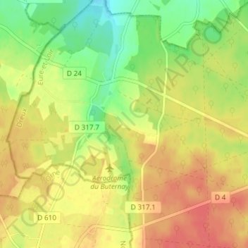
Le Bas Coudray topographic map
Interactive map
Click on the map to display elevation.
About this map
Name: Le Bas Coudray topographic map, elevation, terrain.
Average elevation: 245 m
Minimum elevation: 217 m
Maximum elevation: 267 m
Other topographic maps
Click on a map to view its topography, its elevation and its terrain.
Bourg Neuf
France > Centre-Val de Loire > Eure-et-Loir > La Ferté-Vidame
Bourg Neuf, La Ferté-Vidame, Dreux, Eure-et-Loir, Centre-Val de Loire, France métropolitaine, 28340, France
Average elevation: 260 m
La Vènerie
France > Centre-Val de Loire > Eure-et-Loir > La Ferté-Vidame
La Vènerie, La Ferté-Vidame, Dreux, Eure-et-Loir, Centre-Val de Loire, France métropolitaine, 28340, France
Average elevation: 251 m