
Thank you for supporting this site ❤️
Make a donation
Make a donation
Fairfield County topographic map
Click on the map to display elevation.
Thank you for supporting this site ❤️
Make a donation
Make a donation
About this map
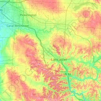
Name: Fairfield County topographic map, elevation, terrain.
Location: Fairfield County, Ohio, United States (39.55440 -82.84294 39.94106 -82.36606)
Average elevation: 282 m
Minimum elevation: 220 m
Maximum elevation: 375 m
Thank you for supporting this site ❤️
Make a donation
Make a donation
Other topographic maps
Click on a map to view its topography, its elevation and its terrain.