
Thank you for supporting this site ❤️
Make a donation
Make a donation
Wallula topographic map
Click on the map to display elevation.
Thank you for supporting this site ❤️
Make a donation
Make a donation
About this map
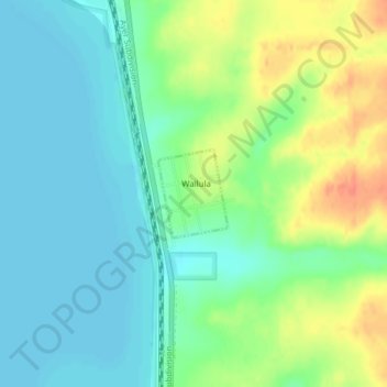
Name: Wallula topographic map, elevation, terrain.
Location: Wallula, Walla Walla County, Washington, United States (46.08161 -118.90909 46.08779 -118.90208)
Average elevation: 119 m
Minimum elevation: 102 m
Maximum elevation: 151 m
Thank you for supporting this site ❤️
Make a donation
Make a donation
Other topographic maps
Click on a map to view its topography, its elevation and its terrain.
Whitman Mission National Historic Site
United States > Washington > Walla Walla County
Average elevation: 196 m
Thank you for supporting this site ❤️
Make a donation
Make a donation