
Barangay 66A topographic map
Interactive map
Click on the map to display elevation.
About this map
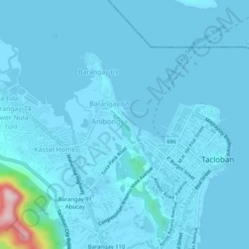
Name: Barangay 66A topographic map, elevation, terrain.
Location: Barangay 66A, Tacloban, Eastern Visayas, 6500, Philippines (11.22918 124.97268 11.26918 125.01268)
Average elevation: 14 m
Minimum elevation: -1 m
Maximum elevation: 282 m
Other topographic maps
Click on a map to view its topography, its elevation and its terrain.
Barangay 67
Barangay 67, Tacloban, Eastern Visayas, 6500, Philippines
Average elevation: 14 m
Sitio Costa Brava
Philippines > Tacloban > Barangay 86
Sitio Costa Brava, Barangay 86, Tacloban, Eastern Visayas, 6500, Philippines
Average elevation: 1 m
Barangay 79
Barangay 79, Tacloban, Eastern Visayas, 6500, Philippines
Average elevation: 5 m
Barangay 77
Barangay 77, Tacloban, Eastern Visayas, 6500, Philippines
Average elevation: 6 m