
Thank you for supporting this site ❤️
Make a donation
Make a donation
Saint-Pierre-de-Broughton topographic map
Click on the map to display elevation.
Thank you for supporting this site ❤️
Make a donation
Make a donation
About this map
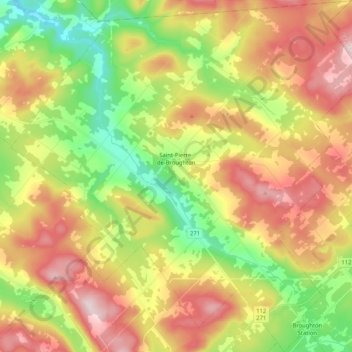
Name: Saint-Pierre-de-Broughton topographic map, elevation, terrain.
Average elevation: 436 m
Minimum elevation: 237 m
Maximum elevation: 664 m
Thank you for supporting this site ❤️
Make a donation
Make a donation
Other topographic maps
Click on a map to view its topography, its elevation and its terrain.
Thank you for supporting this site ❤️
Make a donation
Make a donation
Lac-Bécancour
Canada > Québec > Les Appalaches > Thetford Mines > Lac-Bécancour
Average elevation: 420 m
Thank you for supporting this site ❤️
Make a donation
Make a donation
Petit lac Saint-François
Canada > Québec > Les Appalaches > Saint-Joseph-de-Coleraine
Average elevation: 330 m
Thank you for supporting this site ❤️
Make a donation
Make a donation