
Rönne topographic map
Interactive map
Click on the map to display elevation.
About this map
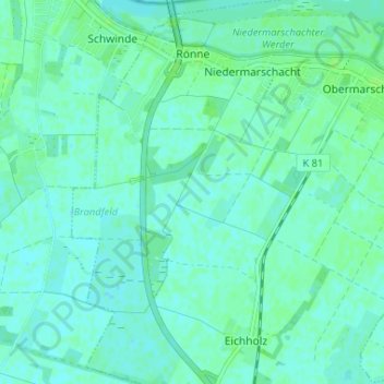
Name: Rönne topographic map, elevation, terrain.
Average elevation: 4 m
Minimum elevation: 1 m
Maximum elevation: 8 m
Other topographic maps
Click on a map to view its topography, its elevation and its terrain.
Stöckte
Allemagne > Basse-Saxe > Harbourg (arrondissement) > Winsen (Luhe)
Stöckte, Winsen (Luhe), Harbourg (arrondissement), Basse-Saxe, 21423, Allemagne
Average elevation: 4 m
Graben 50
Allemagne > Basse-Saxe > Harbourg (arrondissement) > Obermarschacht
Graben 50, Obermarschacht, Marschacht, Samtgemeinde Elbmarsch, Harbourg (arrondissement), Basse-Saxe, 21436, Allemagne
Average elevation: 7 m